

Lampedusa is the largest of the Pelagie Islands and the southernmost inhabited island in Italy. It lies closer to the Tunisian coast than to Sicily, a geographical position reflected in its dry landscape, warm climate and intensely coloured sea.
The island covers approximately 20 square kilometres. Its small size makes it relatively easy to explore, but spending five to seven days allows enough time for beaches, a boat trip and a few walks without having to move continuously from one place to another.
What to see in Lampedusa
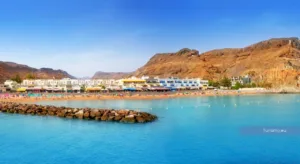
Lampedusa is known primarily for its coastline. Sandy beaches, rocky coves, cliffs and shallow turquoise water alternate around an island whose northern and southern shores have very different characteristics.
The southern coast is generally more accessible and contains most of the beaches, while the northern side is dominated by higher cliffs and is easier to appreciate from the sea.
Spiaggia dei Conigli
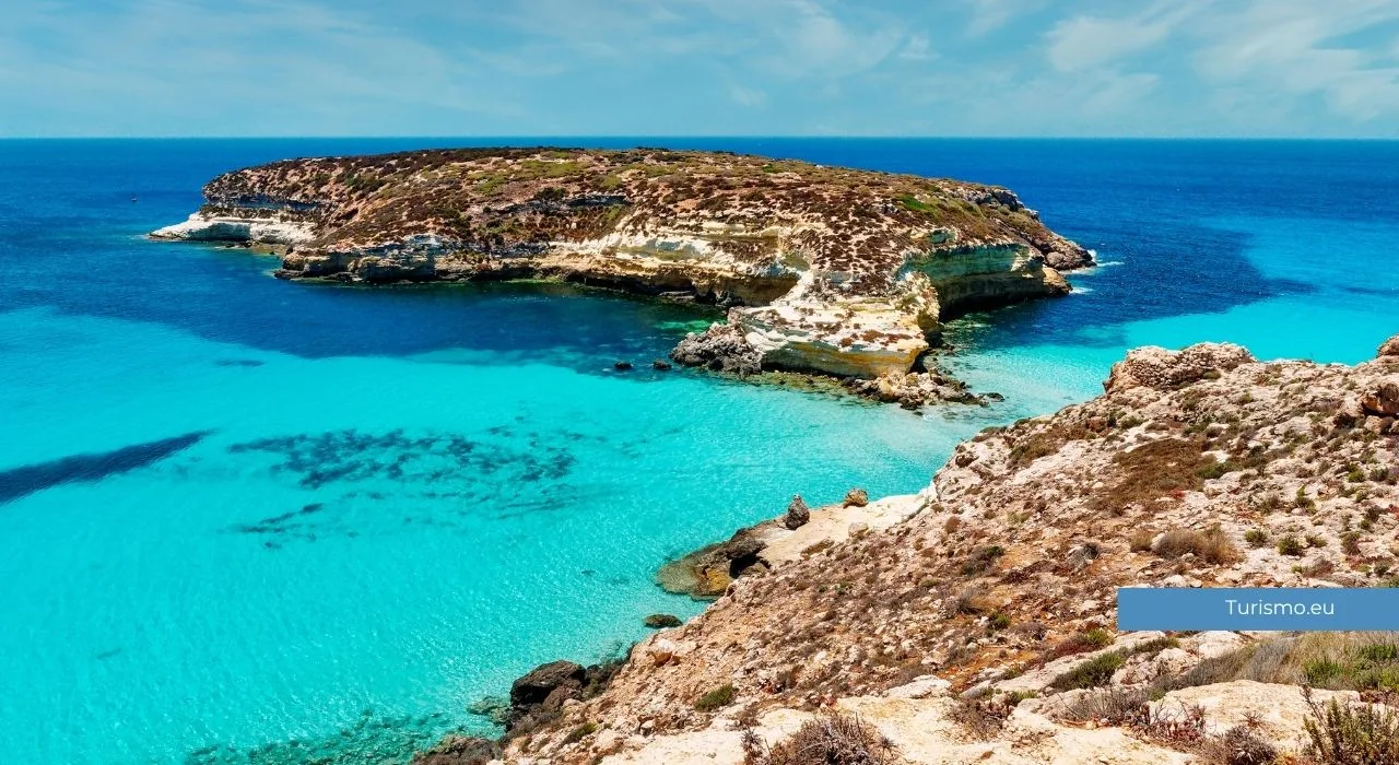
Spiaggia dei Conigli is Lampedusa’s best-known beach and forms part of a protected nature reserve.
The beach has fine pale sand and shallow, transparent water. It is also one of Italy’s most important nesting areas for loggerhead sea turtles.
During the main visitor season, access is limited and advance booking may be compulsory. Entry is normally organised in separate morning and afternoon sessions, and visitors must leave the reserve at the end of their allocated period.
The system and operating dates can change from year to year, so the current arrangements should always be checked before travelling.
There are no conventional beach facilities within the protected area. Visitors should bring water, sun protection and everything necessary for their stay, while respecting the rules of the reserve.
Sea turtle nesting and hatching are natural events and cannot be predicted or treated as tourist performances. Protected areas may be closed or restricted when required by conservation work.
Cala Pulcino
Cala Pulcino lies within the protected area near Spiaggia dei Conigli.
It can be reached on foot along a trail through dry Mediterranean vegetation. The precise duration depends on the starting point and walking conditions, so it should not be considered a quick walk from every access point.
The cove is surrounded by pale rock and has clear water suitable for swimming when the sea is calm. There are no services, shade or places to obtain water.
The route can be tiring during the hottest part of the day. Closed shoes, sufficient water and sun protection are advisable.
Guitgia
Guitgia is one of the most accessible and best-equipped beaches on the island.
It lies close to the town and harbour and has beach clubs, restaurants and accommodation nearby. This makes it suitable for travellers who prefer easy access and services rather than a remote cove.
Its convenient position also means that it can become crowded during the summer.
Cala Croce and Cala Madonna
Cala Croce and Cala Madonna are two small bays along the southern coast.
Both are relatively sheltered and contain areas suitable for swimming. Their accessibility and proximity to accommodation make them practical alternatives to the more remote parts of the island.
Available facilities and the amount of free beach space vary, particularly during the high season.
Cala Francese
Cala Francese lies on the eastern side of Lampedusa, not far from the airport.
The bay combines rocks, sand and clear water and is generally easy to reach. Its position makes it suitable for a shorter beach visit or for the first or final day of a trip.
As elsewhere on the island, swimming conditions depend on wind direction and the state of the sea.
The northern cliffs
The northern coast has a very different appearance from the beaches of the south.
High cliffs descend towards deep water, and many sections cannot be reached easily from land. Viewpoints along the coastal roads provide broad views, but a boat trip offers a clearer impression of the height and shape of the cliffs.
The lack of shade and exposed terrain make walks in this area demanding during the summer. Visitors should avoid approaching cliff edges and follow any barriers or local restrictions.
Albero Sole and the western coast
Albero Sole stands near the highest part of Lampedusa, on the western side of the island.
The surrounding area provides extensive views over the coastline and open sea. Its exposed position also means that it can be very windy.
The western coast is suitable for a scenic drive and short stops, particularly towards the end of the day. Roads and viewpoints should be approached carefully, as some areas have limited protection and uneven ground.
The Sanctuary of the Madonna di Porto Salvo
The Sanctuary of the Madonna di Porto Salvo is one of Lampedusa’s principal religious sites.
The present complex is connected with a much older place of worship used over the centuries by people travelling through the Mediterranean. Its sheltered setting and surrounding vegetation distinguish it from the island’s more exposed landscapes.
The patronal festival takes place in September and remains an important event for the local community.
Lampedusa town and the harbour
The main settlement is concentrated around Via Roma and the harbour.
Via Roma contains shops, cafés, restaurants and evening meeting places. The centre is small and can easily be explored on foot.
The harbour is divided into different areas used by fishing boats, ferries and excursion vessels. It is one of the best places to observe the island’s continuing relationship with fishing and maritime transport.
Lampedusa has also played a central role in recent Mediterranean migration. Local cultural spaces and exhibitions address this history, although opening hours should be checked before planning a visit.
Boat trips around Lampedusa
A boat trip is one of the most useful ways to understand the island’s coastline.
Excursions generally travel around part or all of Lampedusa, with swimming stops chosen according to wind and sea conditions. The route may include Cala Francese, Cala Madonna, Cala Pulcino and sections of the northern cliffs.
Before booking, check:
- the maximum number of passengers;
- the actual duration of the excursion;
- whether food and drinks are included;
- the number of swimming stops;
- the shaded space available on board;
- the cancellation policy in poor weather.
A full circuit of the island is never guaranteed. The captain may change the route when wind or waves make a section of the coast unsuitable.
A day trip to Linosa
Linosa is the other inhabited island in the Pelagie archipelago and has a completely different landscape from Lampedusa.
Its volcanic origins are visible in its dark rocks, craters and small cultivated areas. The island is quieter and less developed for tourism, with a compact village and a coastline largely formed by lava.
Hydrofoil connections make a day trip possible when schedules and sea conditions allow. However, services are not equally frequent throughout the year, and cancellations can occur in rough weather.
Travellers particularly interested in Linosa may prefer to spend at least one night there rather than depend on a same-day return.
When to visit Lampedusa
The main travel season runs from late spring to early autumn.
May and June are suitable for walking and exploring the island before the busiest period. The sea may still feel cool at the beginning of the season, but temperatures are generally comfortable.
July and August are the hottest and most crowded months. Accommodation prices increase, the best-known beaches become busy and vehicles should be booked well in advance.
September is often a good compromise between warm sea temperatures and lower visitor numbers, although it remains a popular month.
October can still provide suitable conditions for swimming, but weather and transport services become less predictable later in the month.
During winter, the island remains inhabited, but many tourism-related businesses reduce their hours or close.
Getting around Lampedusa
The island is small, but distances can feel longer because beaches and viewpoints are spread across different parts of the coast.
Scooters and small cars are the most commonly used options. A scooter is practical in good weather but provides little protection from sun, wind or sudden rain.
Bicycles can be used for shorter journeys, although heat, wind and exposed roads should not be underestimated.
Local bus services connect some of the principal areas, but timetables and frequency should be checked locally. Taxis and transfer services provide an alternative for travellers who do not want to hire a vehicle.
During the high season, it is advisable to reserve transport before arrival.
How to reach Lampedusa
Lampedusa has an airport with seasonal and year-round connections that vary according to the departure city and time of year.
Ferries and hydrofoils connect the Pelagie Islands with Porto Empedocle in Sicily. Journey times and services depend on the type of vessel and sea conditions.
Flights are generally the quickest option, while travelling by ferry may be useful for those bringing a vehicle. Current schedules, vehicle restrictions and luggage conditions should be checked before booking.
Where to stay
Staying near Via Roma or the harbour provides easier access to restaurants, shops and evening activities.
The Guitgia area is practical for travellers who want to be close to a beach while remaining within reasonable distance of the town.
Accommodation in more isolated parts of the island offers greater quiet but usually makes a vehicle necessary. Before booking, it is useful to check the precise location rather than relying only on the name of the area.
Some properties offer airport or harbour transfers, which can be particularly helpful on arrival.
How long to spend in Lampedusa
Five days are sufficient for the principal beaches, a boat trip and an initial exploration of the island.
A full week provides more flexibility in case of wind or rough seas and allows different stretches of coast to be visited without filling every day with activities.
Those planning a trip to Linosa or interested in walking should allow additional time. Sea conditions can alter excursion and transport plans, making a flexible itinerary particularly useful.