-
 Italiano
-
 English
In south-eastern Sicily, towns rise across plateaus, hillsides and deep valleys carved into the Hyblaean Mountains. Pale stone façades change colour throughout the day, stairways connect neighbourhoods built at different elevations and, closer to the coast, the landscape opens into salt pans, beaches and wetlands.
A journey through the Val di Noto combines the towns of Sicilian Baroque with the Vendicari Nature Reserve and coastal villages. Noto, Modica, Scicli and Ragusa Ibla are the principal stops on a route requiring at least four days. The trip can be extended to include Syracuse, Marzamemi and other places in the Hyblaean Mountains.
What is the Val di Noto?
Despite its name, the Val di Noto is not a valley surrounding the town of Noto. The term comes from the Vallo di Noto, one of the administrative districts into which Sicily was divided for several centuries. Its territory covered a large part of the island’s south-east.
The urban history of the area is closely linked to the earthquake of 1693, which destroyed or severely damaged numerous towns. The subsequent reconstruction resulted in entirely new towns or neighbourhoods built beside the former settlements, following the architectural and urban principles of the late Baroque period.
In 2002, UNESCO designated eight towns in south-eastern Sicily as a World Heritage Site: Caltagirone, Militello in Val di Catania, Catania, Modica, Noto, Palazzolo Acreide, Ragusa and Scicli.
The designation does not therefore cover the entire region. It applies to specific historic centres, neighbourhoods and buildings that document the reconstruction following the earthquake.
Noto and the rebuilt town
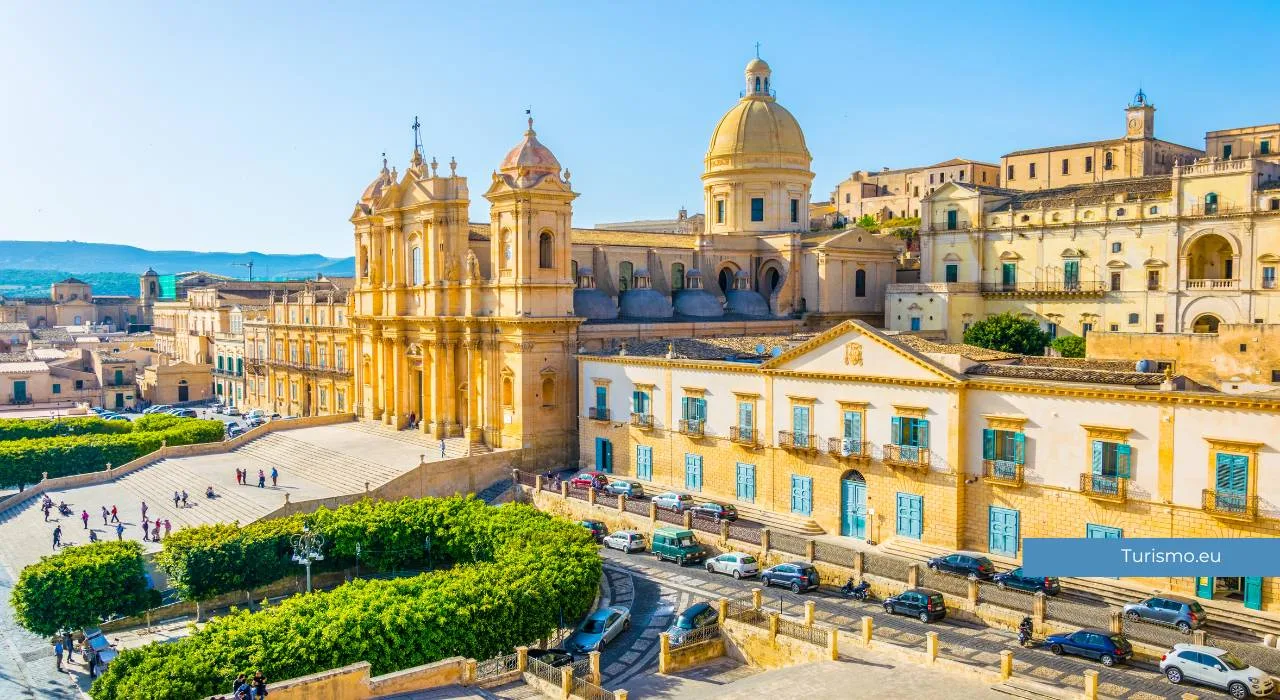
Noto is the place most immediately associated with Sicilian Baroque. The present town was built in a different location from the medieval settlement destroyed in 1693, now known as Noto Antica.
The centre develops around Corso Vittorio Emanuele, an urban axis lined with churches, former convents and civic buildings. Entering through Porta Reale, visitors gradually reach the town’s principal squares along a compact route that can be explored entirely on foot.
The centre is dominated by the Cathedral of San Nicolò, reached by a broad staircase and facing Palazzo Ducezio. Rather than trying to enter every building, it is worth observing the relationship between the façades, squares and side streets climbing towards the upper part of town.
One of the most interesting diversions follows Via Nicolaci, known for its balconies supported by carved corbels depicting people, animals and imaginary creatures. In May, the street hosts the Infiorata di Noto and is covered with compositions made from flower petals and other plant materials.
A few hours are sufficient for a walk through the centre, but a full day provides time to visit the buildings open to the public, reach panoramic viewpoints and see the stone façades take on warmer tones in the late afternoon.
Vendicari Nature Reserve
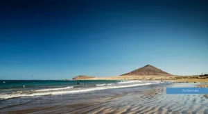
Around twenty kilometres from Noto, Vendicari protects a stretch of coastline formed by marshes, salt pans, beaches, Mediterranean vegetation and remains connected with former fishing activities.
The reserve is particularly important for migratory birds, which use its wetlands while travelling between Europe and Africa. The species present vary with the seasons, and sightings can never be guaranteed.
Vendicari has several entrances located some distance from one another. There is therefore no single route covering the entire reserve. Before visiting, it is necessary to choose an area according to the time available and the type of walk preferred.
From the main entrance, paths lead to Vendicari beach, the Swabian Tower and the former tuna fishery. This route combines the natural landscape with structures once used for processing tuna.
Calamosche is a small bay enclosed by two rocky headlands. It must be reached on foot from the car park, along a trail exposed to the sun. During summer, it is advisable to avoid the hottest hours and carry sufficient water, as services within the reserve are limited.
Vendicari’s beaches should not be treated simply as bathing areas. They lie within a protected environment, and visitors must remain on the designated paths, avoid damaging vegetation and follow the instructions provided by the reserve management.
Access arrangements, admission fees, parking and temporary closures may change. Current official information should therefore be checked before visiting.
Marzamemi and the coast
Vendicari can be combined with Marzamemi, located a few kilometres further south. The historic centre of the village developed around the former tuna fishery and Piazza Regina Margherita, surrounded by houses once connected with the work of local fishermen.
The village is small and becomes very busy during summer. Walking through the centre does not require much time, but in July and August traffic, parking and crowds can make the visit considerably longer.
Marzamemi is a suitable conclusion to a day in Vendicari, particularly for dinner or an evening walk by the sea. It does not replace the nature reserve, however, as the two places offer completely different coastal environments.
Modica: neighbourhoods, stairways and chocolate
Modica occupies the sides of a deep gorge in the Hyblaean Mountains. The city is mainly divided between Modica Bassa, which developed along the valley floor, and Modica Alta, built across the slopes and connected to the lower town by streets, alleys and stairways.
This urban layout is one of the most interesting aspects of the visit. From the viewpoints, Modica appears as a dense arrangement of overlapping houses, bell towers and terraces.
The Church of San Giorgio stands above a long staircase overlooking the town and is one of the main examples of local Baroque architecture. In the lower district are Corso Umberto I and the Church of San Pietro, also reached by a staircase decorated with statues.
Modica is also known for its chocolate, produced using a low-temperature method that leaves the sugar crystals perceptible. Workshops and shops can be found throughout the centre, but it is worth choosing producers who explain their ingredients and production method rather than relying only on outlets aimed at visitors.
The steep terrain makes it impractical to drive repeatedly between the upper and lower districts. It is generally better to leave the car in a convenient area and explore on foot, bearing in mind the large number of steps.
Scicli, a town between rocky valleys
Scicli lies in a basin crossed by ravines and enclosed by rocky slopes. Compared with Noto, its centre is less monumental and more closely integrated into the structure of the town, with palaces, churches and houses arranged along streets following the valley floor.
Via Francesco Mormina Penna contains some of its most representative buildings and is a natural place to begin the visit. Nearby, Palazzo Beneventano stands out for its balconies and the sculpted figures supporting them.
To understand the town’s position, it is worth climbing towards San Matteo. The route provides views over Scicli’s rooftops and the rocky walls surrounding the settlement. The ascent is steep and is best attempted in the morning or late afternoon on hot days.
Scicli can be visited on the same day as Modica, as the two towns are little more than ten kilometres apart. To avoid rushing through a succession of churches and palaces, it is better to spend the morning in Modica and the afternoon in Scicli, or stay overnight in the area.
Ragusa Ibla and Ragusa Superiore
Ragusa consists of two distinct centres, separated by the terrain and by the history of its reconstruction. After the earthquake of 1693, some residents rebuilt the city on the upper plateau, while others remained in the area of the former settlement, now known as Ragusa Ibla.
The best way to understand this structure is to begin in Ragusa Superiore and walk downhill towards Ibla. Along the route, viewpoints overlook the rooftops, the dome of the Cathedral of San Giorgio and the houses arranged across the slope.
Ragusa Ibla is formed by irregular streets, stairways and small squares. The Cathedral of San Giorgio dominates the main square, but much of the town’s interest lies in the relationship between its buildings and the terrain on which they were constructed.
Continuing towards the eastern end of Ibla leads to the Giardino Ibleo, a tree-lined garden overlooking the valley. It can mark the end of the route before returning to Ragusa Superiore.
The difference in elevation between the two parts of the city should not be underestimated. Travellers who do not want to climb back on foot can organise the journey by car or check the available local transport services.
Getting around the Val di Noto
A car is the most practical way to follow this route. The principal towns are also connected by bus, but timetables can restrict visits and make it more difficult to reach Vendicari, the beaches and rural accommodation.
Distances are not particularly great, but secondary roads and access to historic centres require time. In Modica and Ragusa, it is also necessary to account for steep slopes and neighbourhoods situated at different elevations.
It is generally advisable to park at the edge of the historic areas and continue on foot, avoiding streets with restricted access. Before travelling, check the locations of car parks and any limited traffic zones.
When to visit the Val di Noto
Spring and autumn provide more comfortable temperatures for exploring the towns on foot and walking through Vendicari Nature Reserve. The main destinations are also generally less crowded than during summer.
Summer makes it easier to combine the journey with time at the beach, but the middle of the day can be extremely hot. Noto, Modica, Scicli and Ragusa all contain steep sections with little shade, so walks are best planned for the morning and late afternoon.
Vendicari changes throughout the year according to water levels in the marshes and the seasonal passage of migratory birds.
Travellers mainly interested in observing wildlife should check the most suitable periods before visiting and bring binoculars.