Gran Canaria has much more to offer beyond its coastline. Leave the southern beach resorts and head inland to discover ravines, pine forests, ancient calderas and mountains rising to almost 2,000 metres.
The trail network crosses very different landscapes. Some routes lead to island landmarks such as Roque Nublo; others follow historic paths between small villages, woodland and agricultural terraces. There are short walks suitable for most people, alongside routes requiring a full day, good fitness and more careful preparation.
Before setting out, assess not only the distance but also the elevation gain, terrain and mountain weather conditions.
Gran Canaria’s hiking trails at a glance
- Roque Nublo → the island’s best-known trail
- Pico de las Nieves → views across the central mountains
- Ventana del Nublo → a natural arch framing Roque Nublo
- Caldera de Bandama → a walk inside a volcanic crater
- Tamadaba → pine forests, plateaus and cliffs overlooking the ocean
- Los Tilos de Moya → a short walk through northern woodland
- Camino de Santiago → a crossing from south to north
- Barranco de las Vacas → a brief visit between water-sculpted rock walls
The most interesting hiking trails in Gran Canaria
Roque Nublo: the island’s iconic walk
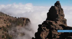
Roque Nublo rises in Gran Canaria’s mountainous heart and is one of the most recognisable landmarks in the archipelago. The monolith stands around 80 metres tall on a plateau surrounded by cliffs, ravines and volcanic peaks.
The shortest route starts near Degollada de la Goleta. The walk is not long, but it includes uphill sections and uneven ground. Near the top, the trail opens onto a broad rocky platform dominated by Roque Nublo and the neighbouring Roque de la Rana.
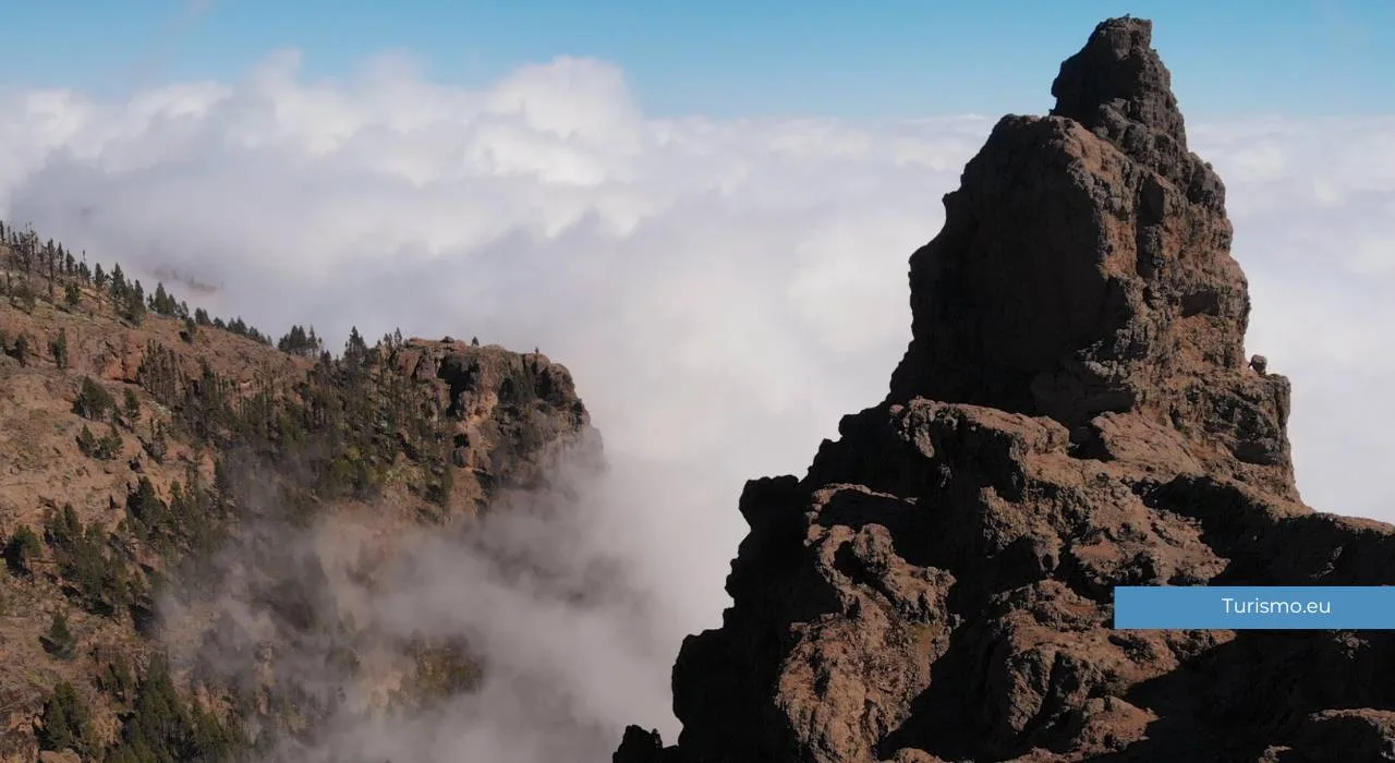
On clear days, views extend to Mount Teide on Tenerife. When clouds rise from the valleys, the landscape changes quickly, and the rocks appear to emerge above a white sea.
Longer routes start from Tejeda, La Culata, Ayacata or trails in the island’s highest areas. These alternatives require more time and involve considerably greater elevation changes than the standard walk.
Access to the S-70 trail from Degollada de la Goleta is regulated during certain hours and requires a free reservation. Before visiting, check availability, transport arrangements and access conditions on the official Roque Nublo booking website. Reservations may be suspended during wildfire alerts.
Pico de las Nieves and the high mountain trails
Pico de las Nieves is commonly described as Gran Canaria’s highest point, although the island’s highest elevation is actually on nearby Morro de la Agujereada. The area nevertheless remains one of the best starting points for exploring the central mountains.
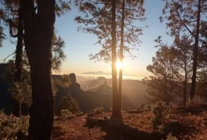
Several routes cross pine forests, viewpoints and high-altitude clearings. Views take in Roque Nublo, Roque Bentayga and the deep inland valleys; Tenerife’s outline also appears when visibility is good.
One particularly enjoyable walk links the Pico de las Nieves area with Llanos de la Pez, passing through Canary Island pine forests and open ground shaped by past eruptions and fires. Other routes reach Degollada de la Goleta or continue towards the Caldera de Tejeda.
Despite the island’s latitude, temperatures here can be low, particularly in winter and early in the morning. Wind, fog and cloud can suddenly reduce visibility.
Ventana del Nublo
Ventana del Nublo is a natural arch framing the outline of Roque Nublo. A trail through the Llanos de la Pez and Bailico area leads to it, crossing pine woodland and volcanic terrain.
The route is less busy than the standard Roque Nublo walk but requires greater attention to navigation. Some sections are steep, and the ground can be slippery or the path difficult to follow, particularly after rain or in fog.
The rock arch is relatively small and stands on the edge of a slope. Approach carefully, without climbing onto the arch or putting yourself at risk for photographs.
This walk suits people with some hiking experience who want to see the central mountains from a different perspective.
Caldera de Bandama
A few kilometres from Las Palmas de Gran Canaria lies the Caldera de Bandama, a large volcanic depression around 200 metres deep. It is one of the more accessible places to explore the island’s geological origins without travelling into the highest mountains.
A path descends from the rim to the caldera floor, where traces of former cultivation, rural buildings and vegetation adapted to volcanic ground remain. The descent is relatively quick, but the return requires climbing back up the same slope.
A second route follows part of the upper rim, offering views across the crater, the northeastern coast and the vineyards of Monte Lentiscal.
The area is exposed to the sun, with little shade along the paths. On hot days, start early and carry enough water.
Tamadaba: pine forests and mountains overlooking the ocean
Tamadaba Natural Park covers a large mountainous area in northwestern Gran Canaria. Canary Island pines dominate the plateau, while to the west the terrain drops steeply towards the coast and the Agaete Valley.
There are numerous walking options. Some form short loops through the pine forest; others reach natural viewpoints, historic settlements and more remote parts of the park.
One of the best-known routes leads to Roque Faneque, an imposing rocky mountain rising above the ocean. The walk crosses pine woodland and approaches exposed sections. It is unsuitable for anyone uncomfortable with heights and requires particular care in wind or fog.
A less demanding alternative is to explore the paths around Llanos de la Mimbre, with views towards Agaete, the western coast and, on clear days, Tenerife.
Los Tilos de Moya
In northern Gran Canaria, Los Tilos de Moya preserves one of the island’s last remaining patches of laurel forest. The scenery is very different from the dry southern mountains: the path crosses a shaded valley with ferns, trees and vegetation associated with wetter environments.
The main route is short and presents no major difficulties. It is suitable for anyone wanting to include an easy walk during a driving itinerary through northern Gran Canaria.
Do not expect an extensive forest like those on La Gomera or La Palma. Los Tilos is a small reserve, but it offers a glimpse of the ancient vegetation that once covered the island’s wetter areas.
You can combine the walk with a visit to Moya’s historic centre, Firgas or a stop along the northern coast.
Gran Canaria’s Camino de Santiago
Gran Canaria’s Camino de Santiago crosses the island from south to north, connecting Maspalomas with Gáldar. The route traverses the central mountains and partly follows paths used by island residents for centuries.
The full route is around 66 kilometres long and is usually divided into three stages. From the dry southern landscapes, it climbs towards Tunte, Cruz Grande and the highlands before descending through rural areas and historic towns to the Church of Santiago de los Caballeros in Gáldar.
It is a demanding crossing, particularly because of the elevation gain and the length of the stages. It requires different planning from a circular day hike: accommodation, luggage arrangements and transport back from the finish all need consideration.
If you prefer not to walk the entire route, choose an individual section. The stage between Tunte and the central highlands is among the most scenic, but also one of the most strenuous.
Barranco de Guayadeque
Barranco de Guayadeque separates the municipalities of Ingenio and Agüimes, extending inland between high rock walls. The area is important both for its natural environment and for its caves, cave dwellings and archaeological remains associated with Gran Canaria’s early inhabitants.
Rather than a single marked trail, Guayadeque offers several ways to explore. Rural tracks and paths follow the ravine or climb towards higher ground, allowing you to plan a route according to the time available.
A short visit provides an introduction to the landscape and an opportunity to stop near the interpretation centre. Longer hikes require a reliable route map or GPS track, as some secondary paths are not always easy to identify.
Barranco de las Vacas: a short walk rather than a hike
Barranco de las Vacas has become famous for a short section of curving rock walls sculpted over time by water. Their shapes resemble those of some canyons in the southwestern United States, although the site is much smaller than photographs may suggest.
This is not a full hiking route. The best-known section is only a few minutes from the access point, and visits are generally brief.
Access is the main difficulty: roadside parking is extremely limited, traffic can make walking along the road dangerous, and the narrow ravine becomes congested during busy periods.
It can be an interesting stop on an itinerary around Agüimes, but it should not replace one of the more substantial walks in the island’s interior.
When to go hiking in Gran Canaria
The most favourable period is generally from October to May. Temperatures are more comfortable for walking, and after rainfall the northern and mountain landscapes become greener.
In winter, however, the summits can experience strong winds, fog, rain and temperatures far lower than those on the coast. Leaving Maspalomas in sunshine does not mean you will find the same conditions at Roque Nublo or Pico de las Nieves.
Summer is less suitable for long hikes. Heat, strong sun exposure and wildfire risk can lead to restrictions or trail closures. In July and August, choose shorter routes, start very early and avoid the middle of the day.
During weather or wildfire alerts, check official updates and respect all closures. Conditions and access arrangements can change during the day.
How to prepare
Gran Canaria packs major differences in elevation and temperature into a small area. Before setting out on a hike:
- Download a route map or GPS track that works offline.
- Check elevation gain and difficulty, not just distance.
- Wear footwear with good grip.
- Carry water, sun protection and a windproof layer.
- Do not rely on finding drinking water or refreshments along the way.
- Avoid ravines when heavy rain is forecast.
- Check for restrictions in protected areas.
- Stay on the trails, particularly in fragile environments.
- Allow enough time to return before dark.
Mobile coverage can be patchy in the mountains. For longer routes, tell someone your planned itinerary and approximate return time.
Exploring inland Gran Canaria on foot
The trails reveal a side of the island that remains hidden from visitors who stay on the coast. Within a few days, you can walk through a volcanic crater, a high-altitude pine forest, a damp valley and a plateau surrounded by rocky peaks.
There is no need to begin with the longest crossing. Combining Roque Nublo, Caldera de Bandama and Los Tilos de Moya already provides a useful introduction to the variety of the interior.
With more time, you can explore Tamadaba, walk a stage of the Camino de Santiago or plan a route between the central mountain villages. Walking offers one of the clearest ways to appreciate the complexity of Gran Canaria’s landscapes.