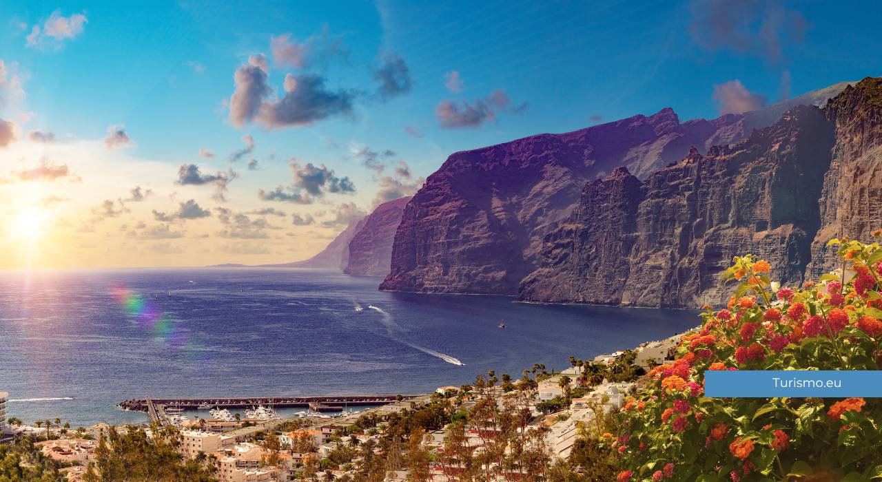


On the western coast of Tenerife stand the highest cliffs on the island. The Acantilados de Los Gigantes drop vertically into the ocean for hundreds of metres, creating one of the most powerful landscapes in the Canary Islands.
This is not a place to pass through quickly. It is a place to stop, look, and let the scale of the landscape do its work.
How these cliffs were formed
The cliffs of Los Gigantes are of volcanic origin, like much of Tenerife’s landscape.
Over millions of years, erosion by sea and wind shaped these rock faces until they became almost vertical. In some places they reach 600 metres in height, dropping directly into the ocean with no beaches or transitional zones.
The contrast between the black of the volcanic rock and the deep blue of the Atlantic is immediate and hard to forget.
Seeing them from the sea
The best way to understand the true scale of the cliffs is to observe them from the water.
From the port of Los Gigantes, daily boat excursions depart and head directly beneath the rock faces. Only from there can you truly appreciate the height and verticality of these formations.
During excursions, cetacean sightings are frequent: this part of the ocean is one of the most stable habitats for pilot whales and common dolphins, present year-round in the waters between Tenerife and La Gomera.
The port and village of Los Gigantes
At the foot of the cliffs lies the small centre of Los Gigantes, a tourist village developed around the port.
It is not a place of great historical interest, but it is a convenient base for boat excursions and for spending a few days in a quiet part of the island. The port is well equipped and ferries to La Gomera also depart from here.
Los Gigantes beach is of dark volcanic sand, set in a small sheltered bay. It is not large, but well protected from the wind and well suited for a day by the sea.
Masca and the Teno mountains
Not far from Los Gigantes lies one of the most isolated corners of Tenerife.
The village of Masca is perched among the mountains of the Macizo de Teno, just a few kilometres as the crow flies but reachable only along a winding road that climbs between the rocks. The landscape along the way is already one of the most spectacular on the island.
From Masca a trail descends to a small beach on the sea, reachable only on foot or by boat. It is one of the most famous hikes in Tenerife, but requires physical preparation and care.
Punta de Teno
At the westernmost tip of the island lies Punta de Teno, the furthest west point of Tenerife.
Access is regulated and takes place by shuttle from Buenavista del Norte. Once there, a landscape of low cliffs, open sea and a small lighthouse facing the Atlantic opens up.
It is one of the quietest spots on the island, far from mass tourism.
Practical information
Boat excursions depart from the port of Los Gigantes and generally last between 2 and 4 hours. Booking in advance is recommended, especially in the summer months. Some excursions include snorkelling in sheltered areas along the coast.
To visit Masca independently a car is necessary. The road is narrow and winding but manageable without difficulty with a little care.
When to go
This part of the island can be visited year-round. The climate is generally drier and sunnier than the north, and boat excursions run in every season.
In the summer months visitor numbers are higher, but the cliffs remain accessible without any particular issues.